The Pedestrian Working Group has hit full stride (pun intended)! After over two years of collaboration, iteration, and extended conversations about crosswalks, the group is excited to announce the Pedestrian Working Group Sidewalk Mapping Schema version 1.0!
In March 2024, stakeholders across the sidewalk mapping community began meeting regularly to start building a set of shared priorities for future mapping and data collection efforts in the United States. The Pedestrian Working Group (PWG) includes representatives from academia, state and federal government, the nonprofit and private sectors, and plenty of individual volunteers. While the PWG is focused on mapping in the United States and the majority of members are based here, we’ve also been joined by mappers from across the globe.
This schema is a collection of pedestrian infrastructure mapping best practices and tagging norms currently in use in the United States, organized in four tiers aligned with different accessibility needs, navigation abilities, and source data quality. The tiers (bronze, silver, gold, and diamond) target levels of data usefulness that can be achieved incrementally. This allows for straightforward analysis of the current state of a region’s sidewalk data, or for local communities to set concrete goals and milestones in their mapping campaigns. The schema encompasses the built environment that pedestrians rely on as markers of safety, permission, and accessibility: sidewalks, crossings, and their related signals and buttons, tactile paving markers, curbs, traffic islands, and access aisles primarily. There is a corresponding PWG Sidewalk Mapping Guide, providing a more digestible overview for new sidewalk mappers.
This schema is not doctrine, nor is it definitive documentation of how the global OpenStreetMap community should map sidewalks. It is informed by the experiences of volunteer mappers and pedestrians primarily in the United States, where the overwhelming popularity of personal vehicles has led to systemic disinvestment in pedestrian infrastructure across many regions of the country.
In the past few months, we’ve seen multiple tools, programs, and presets designed to interact with the Pedestrian Working Group schema pop up. Here are just a few examples:
-
Speedwalk, by Tobias Jordans (FixMyCity) and Dustin Carlino, is a web app that visualizes where sidewalks are separately mapped and where they are tagged as part of the adjacent roadway to help mappers identify areas that need attention.
-
Kevin Ratzel created a “Pedestrian Working Group Visualizer” that uses Ultra to color-code sidewalks and crossings depending on which tier of the schema they align with.
-
There are now JOSM presets by member and “Keeper of the Wiki” Amy Bordenave that make it easy to map according to the PWG schema.
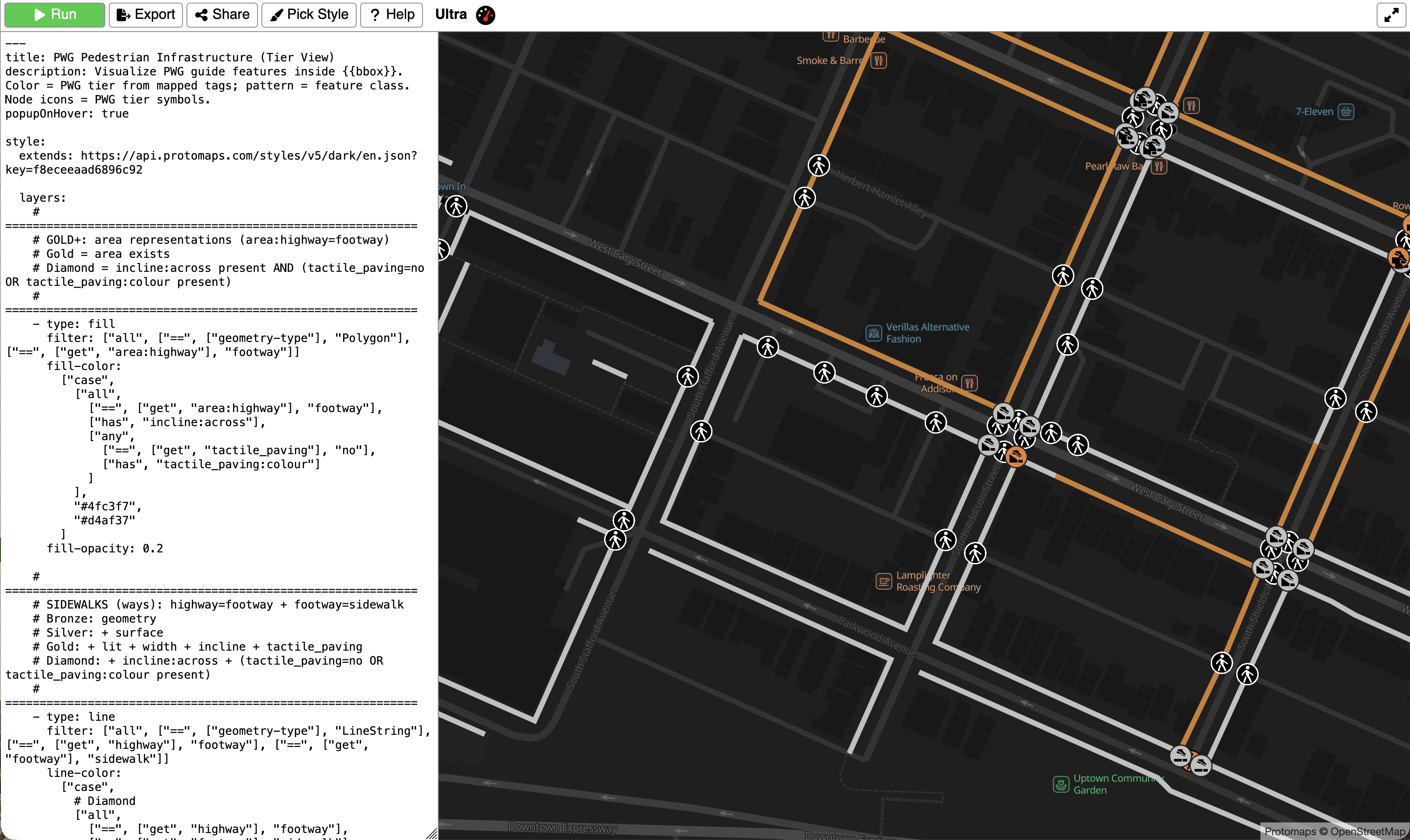
Kevin’s Pedestrian Working Group Visualizer
The PWG is excited to continue improving on this schema in future versions and invites pedestrians, mappers, and pedestrian mappers to join the process. If you have feedback, you’re welcome to share your thoughts through these forums:
-
Come to a PWG meeting! We meet every third Tuesday of the month on Zoom at 3:00 pm Eastern. Attendance is open to all. Please fill out this form to get involved.
-
Propose a change or make a comment on the talk page of the draft schema, and we’ll discuss it in future meetings.
-
Send any questions or comments to pedestrian@openstreetmap.us
If you’d like to learn more about the process of drafting this Schema and what goes on in the Pedestrian Working Group, here are a few resources:
-
The recording of “Walking the Walk: A Year of Progress with the OSM US Pedestrian Working Group” at State of the Map US 2025
-
The recording of the July, 2025 Mappy Hour “Let’s Map some Sidewalks”
-
The PWG meeting agenda archive
The Pedestrian Working Group would like to extend a sincere thank you to co-chairs Chad Blevins and Alyssa Castronuovo, to Jacob Hall for pioneering the tiered schema approach and brainstorming phase, to Amy Bordenave for overseeing schema development and documentation, and to everyone who joined a meeting, contributed to the development and improvement of the schema and guide, or helped create related pedestrian-mapping tools.
Interested in joining the conversation? Fill out our working group interest form.