
Building the world’s most out-of-date map
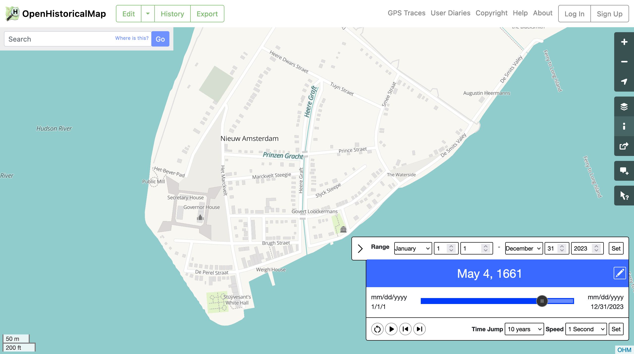
OpenStreetMap for Roman roads? Middle Kingdom cities? 1890s railways? OpenHistoricalMap is aiming to create the most comprehensive, most out-of-date map of everything that’s existed from Then through Now.
Meet the team
News and talks
See all postsMapper Highlight: OpenHistoricalMap(pers)
Browsing through openhistoricalmap.org is a personal tour of passion projects, obsessions, and areas of awe-inspiring expertise. The area of the map you’re looking at may appear sparse, save for a few boundaries,...
Historical Mapping with OpenHistoricalMap, OldInsuranceMaps.net, and Yesterdays
From georeferencing historical Sanborn fire insurance maps on OldInsuranceMaps.net, to georeferencing historical photographs, to mapping through time on OpenHistoricalMap, we’ll share demos and how to get involved.
Charter Projects Face Uncertain Future as Financial Support Ends
Many of the best OpenStreetMap tools emerge organically as personal projects built by members of the global community. Informal structures can be great for getting a project off the ground, but at...
OpenHistoricalMap Office Hours
Join the OpenHistoricalMap community for our annual informal office hours. Get advice from fellow mappers, brainstorm some focus areas for the coming year, and give feedback to the OHM advisory group.