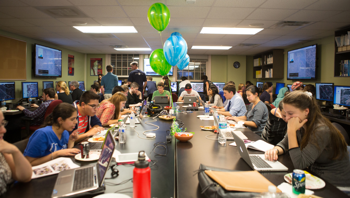
With the upcoming State of the Map US conference at the United Nations I am proud to announce TeachOSM, a focal point for educators and instructors who integrate OpenStreetMap in their classroom and lessons. TeachOSM is about using OpenStreetMap to teach basic geographic concepts and in the process, train the next generation of mappers. It taps into the experience of early adopters in education like Nuala Cowan, Richard Hinton, Stephanie May and Mikel Maron and builds from there. It is intended as a community and resource for teachers across all levels of the education system.
With last year’s observation of the tenth anniversary of the OpenStreetMap project we can safely say it is a mature project. It is an established platform for doing interesting things with geographic information. Enterprising people are building services on it, such as routing, hyperlocal geography, and open source street views. It has entered the geospatial mainstream.
“How can we foster the use of OpenStreetMap to cultivate geo-literacy?”
Put simply, the goal of TeachOSM is to open up the OpenStreetMap tool chest and give youth the basic tools for making spatial sense of their world, expose them to the geographer’s craft, and build social capital at a grassroots level. There are two parts to this. One is geographic: instill basic location awareness and spatial reasoning. How can we foster the use of OpenStreetMap to cultivate geo-literacy? The second part is to build social fabric and cultivate citizenship: cultivating an awareness of place, what makes it unique, how we really engage with our surroundings, creating visions of what could be, and being able to use the map to explore what might be.
TeachOSM is loosely divided into two tracks. The teacher track focuses on developing editing competency with the OpenStreetMap platform as well as how to conduct repeatable mapping activities, Tasking Manager basics, and how to assess data quality (or assign grades). Like the teacher track, the student track also aims to establish competency with the OpenStreetMap platform, but also offer service-based learning opportunities for students who choose to contribute to projects such as MapGive, MissingMaps, Humanitarian OpenStreetMap Team, and other qualifying projects. By June, we hope to establish two badges – microcredentials that students can obtain after demonstrating basic mapping competency with OpenStreetMap.
“Teaching people to use OpenStreetMap encourages them to engage with a place and a community”
As a platform, OpenStreetMap is uniquely positioned to achieve these objectives. It provides the user with a means to acquire spatial reasoning and location awareness. On another level, teaching people to use OpenStreetMap encourages them to engage with a place and a community. Helping younger people adopt a sense of place, make sense of their world, take ownership of it is an investment in developing a pipeline of new OpenStreetMappers, and thereby put the OpenStreetMap community on a sustainable trajectory for the next 10 years.
As good as our OpenStreetMap platform is, the real work remains in outreach to educational institutions and establishing on-going relationships with educators, instructors, community organizers, and those who would assume a teaching role. To facilitate this outreach, we have plans to kick off OSM Summer Camp, a series of half-day workshops to train teachers on not just mapping, but in creating their own sustainable and repeatable mapping projects. There is plenty of work to be done, so if you’d like to help out, please contact us through the TeachOSM website.
Join the conversation at State of the Map US June 6 - 8 2015, look out for sessions on education (schedule to be announced) on June 6th and 7th and a workshop for teachers on June 8th.
Photo: OpenStreetMap classes at the geography department of George Washington University


