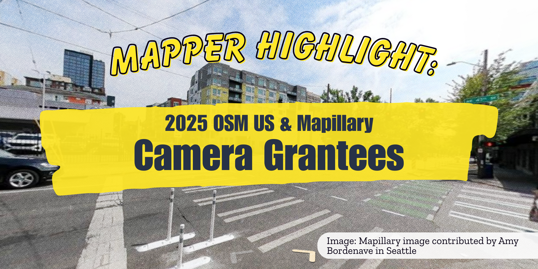
Since the launch of the OSM US & Mapillary Camera Grant Program in April of this year, 21 grantees have uploaded over 3 million images to Mapillary, and grant packages have been shipped to New Jersey, Ohio, Alaska, and beyond. For this entry in our Mapper Highlight series, we want to take a moment and shout out a few of the grant recipients for their amazing work improving pedestrian and bicycle infrastructure data in Mapillary and OSM.
Amy Bordenave with the University of Washington Taskar Center for Accessible Technology in Seattle, Washington
Tell us about one of your recent excursions to gather street level imagery.
Two capture sessions come to mind! One, a walk around the neighborhood north of Green Lake in Seattle. This was done following OSM Seattle’s meetup to celebrate the 21st birthday of OpenStreetMap. Special thanks to those who joined, including Clifford Snow of the Data Working Group! It was really nice to meet new people and to catch up with people I hadn’t seen since State of the Map US 2025 in Boston. Two, a walk up and down the central main street of Carnation, Washington. Following our participation in the Seattle Design Festival (we also captured all of the festival grounds!) we traveled out to Carnation, a lovely small town in a picturesque rural area, and led a Walkabout with the town’s Mayor as we shared some of the work we’ve been doing at Taskar Center to map pedestrian infrastructure in the state of Washington. Then, I walked all of the way up and down the town’s quaint main street.
Have you used your captured images to improve OpenStreetMap? How so?
Yes! Mapillary coverage makes it much easier to improve pedestrian infrastructure mapping in OpenStreetMap, especially when new construction adds features not yet visible in aerial imagery, or street-level imagery captures small-scale details like surface quality or obstructions that require an on-the-ground perspective to map. I really enjoy seeing the street art and murals around Seattle, and these are often hidden away. With the Mapillary Camera Grant hardware, I can not only easily capture these but also add them to OpenStreetMap, such as these!
Explain your current workflow using the granted equipment. Do you have any tips for new Mapillary contributors?
The process is pretty straight-forward:
-
Identify survey area - use Mapillary to filter for areas without 360 coverage within the last 5 years.
-
Plan a route - currently done by hand or in-the-moment, but I’m looking into using Wandrer, StreetFerret, or something similar.
-
Gear up - make sure camera and phone are charged, wear high-vis clothing, and don’t forget to carry a water bottle for hydration!
-
Travel to location - if necessary, I usually take public transit and answer StreetComplete quests along the way.
-
Capture time! - I suggest keeping a map up on your phone and recording a GPS track. I use CoMaps for this.
-
Transfer, process, and upload - move images to an ingest folder, remove duplicates, and upload using the Mapillary Desktop Uploader.
Additional advice: Read through and follow Mapillary’s guide.
Sean Whitcomb in Phoenix, Arizona
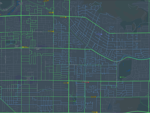
Being part of the OSM US Mapillary camera grant has led to major improvements in the Mapillary coverage in Phoenix and allowed me to ride my bike in new areas of the city I never would have explored otherwise. Since I was awarded the GoPro Max camera, I’ve been focused on capturing 360° imagery of residential streets and bicycle paths in the Phoenix area. Phoenix has decent Mapillary coverage on arterial streets, but is missing many residential streets. Most of the existing imagery is several years old, and almost none of it is 360°. You can see all the streets I’ve added (in light blue) since I received the camera.
What does your current workflow look like?
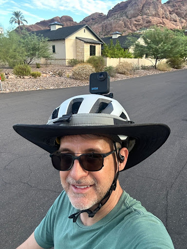
I started this project with the camera on a pole in a backpack while I rode my bike. This was nice because the camera was held high, keeping me out of the frame for the most part. But it was hard to stabilize and resulted in lower quality imagery. So now I attach the camera to my bike helmet. The helmet is visible in the shots–especially with my extra-wide Phoenix sun-blocking brim–but the imagery is clearer.
Once I am in the location where I want to gather imagery, I turn on the camera and sync it with the GoPro Quik app on my phone. I put it in Preview mode so I can see what the camera sees, and I can make adjustments to the position. I also start a GPX track using the free GPX Tracker app to record where I’ve been on this trip. By comparing this track to the coverage map on the Mapillary app, I can be sure I’m gathering all the images I’ve planned to capture on this trip without missing anything. Then I ride my bike up and down streets or trails, pausing the camera when I’m backtracking or covering areas that have previously been captured.
What do you plan to capture next?
This winter, I’ll be working with the local PHXGeo group to capture imagery at Papago Park, a desert preserve that is home to over 1000 saguaro cacti. The park is the site of an annual saguaro survey meant to document this vulnerable population as it struggles with rising temperatures and extreme drought. Most of the saguaros in the park have not been photographed, and I’m hoping to remedy that with the help of Mapillary imagery. Check out this Mappy Hour video to learn more about the Phoenix saguaro mapping project.
Zeyu Wang in Seattle, Washington
Has capturing Mapillary imagery taken you to an area of your city you didn’t previously explore?
When I first received the camera, it happened to be right before a trip to Hawaii, so I decided to bring it along to Honolulu. It turned out to be the perfect opportunity to test the new equipment. I mounted the camera on a convertible and explored the outskirts of the city, focusing on areas that didn’t yet have up-to-date imagery. It felt great to contribute fresh coverage to those less-documented parts of Honolulu.
What are some ways that this program has improved your mapping experience, workflow, or contribution quality?
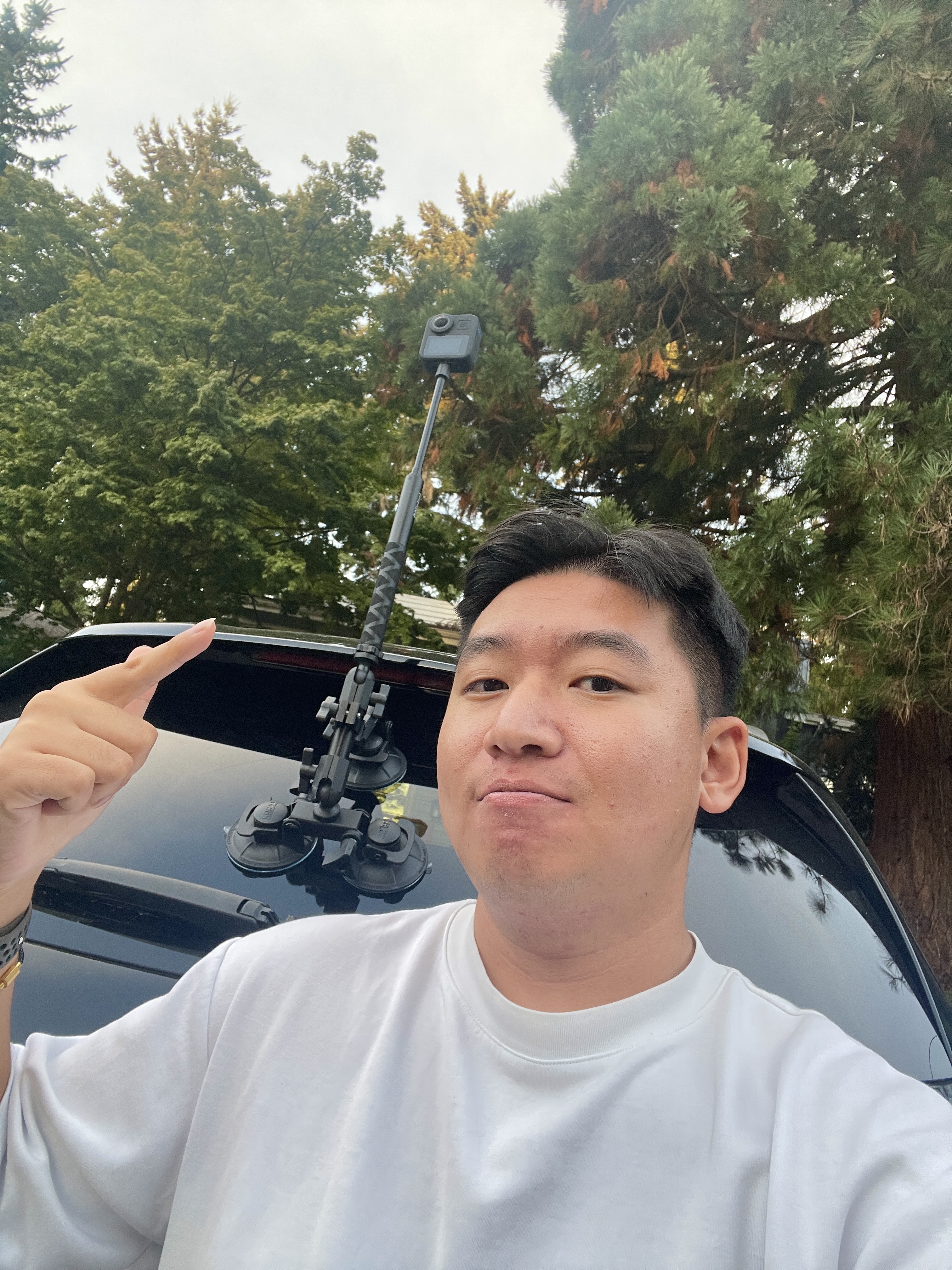
Before the grant, my only option for capturing imagery was using my phone. That meant holding it for long periods of time and constantly worrying about keeping it steady. With the Mapillary Camera Grant Program, I was really impressed by how thoughtfully the package was put together—it included different accessories for different use cases, whether mounting it on a car or using it handheld. The GoPro Max has been especially valuable since it captures 360° videos and photos, providing a panoramic view similar to Google Street View rather than just a single perspective. Overall, it has made the capturing process not only easier and more efficient, but also much more enjoyable with the new equipment.
Thank you to all of the grantees for improving Mapillary and OpenStreetMap! To submit your own application for the OSM US & Mapillary Camera Grant, complete this form.