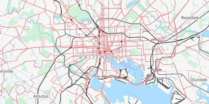
Starting in late 2012, Elliott Plack started adding bus routes in Balitmore. Today he and Mike Pruett continue to improve OSM public transportation, tracking progress on the wiki. The awesome map above shows their achievement.
Let’s follow the trail they blazed by adding bus routes and bus stops in cities all across America. On July 29th - 30th join us in mapping the paths of bus routes and the attributes of bus stops, so they can be included in direction finding tools.
How can I help?
Hop on a bus and ride the full curcuit. And while you do so…
- Record a GPS trace of the route using an app on your phone
- Record amenities of the bus stops like: shelter, seating, and water fountains
- Record other places that you pass by like banks, libraries, restaurants, and parks
The GPS trace you record can be uploaded to OSM and later digitized by you or other mappers. Similarly you can edit the map with new places you found, or share the data you recorded. We’ll teach you how to edit the map.
Do I need any mapping experience?
No. If you’ve ever rode a bus, you have enough experience! We have written up a Bus Mapping Guide that’s suitable for new mappers and experienced mappers. You can dial in your own level of nerdiness.
How do I get started?
Some cities are organizing their mapathons by meeting at a central location and splitting up from there. If you’re city isn’t listed yet, search the internet for local groups in your area, and reach out to the organizer. If you’re feeling up to the task, organize your own mapathon.
If you just want to work on your own, that’s cool too. Just tell people which bus route you’ll be mapping so we don’t duplicate efforts.
