This a guest blog post from OpenStreetMap community member and MaptimeBmore organizer Jonathan Dandois. Do you have a story to tell? OpenStreetMap US news or info to share? Message us at team@openstreetmap.us and we’ll work with you to craft a blog post to share with the community!
Kids love playgrounds and playgrounds are good for kids, parents, and communities. But do children in all neighborhoods have the same access to quality playgrounds? How many playgrounds are within a short walk to a child’s home? Are the playgrounds safe or do they have broken and outdated equipment? Do they have bare soil (which can contain harmful levels of lead and other toxins) or an additive surface like mulch or rubber? MaptimeBmore is teaming up with Baltimore-based Advocates for Children and Youth (ACY) to try to answer these questions using OpenStreetMap. ACY’s mission is to improve the lives and experiences of Maryland’s children through policy change and program improvement. To do this, they require quality data to inform advocacy initiatives and policy changes.
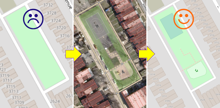
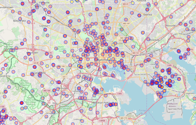
ACY approached MaptimeBmore at the 2019 Baltimore Data Day event to ask how OpenStreetMap data could be used to help understand where playgrounds are and aren’t in Baltimore. A simple Overpass Turbo query for nodes, ways, and relates containing the leisure=playground tag, shows that there are many playgrounds already mapped in Baltimore, but not necessarily where the most people live.
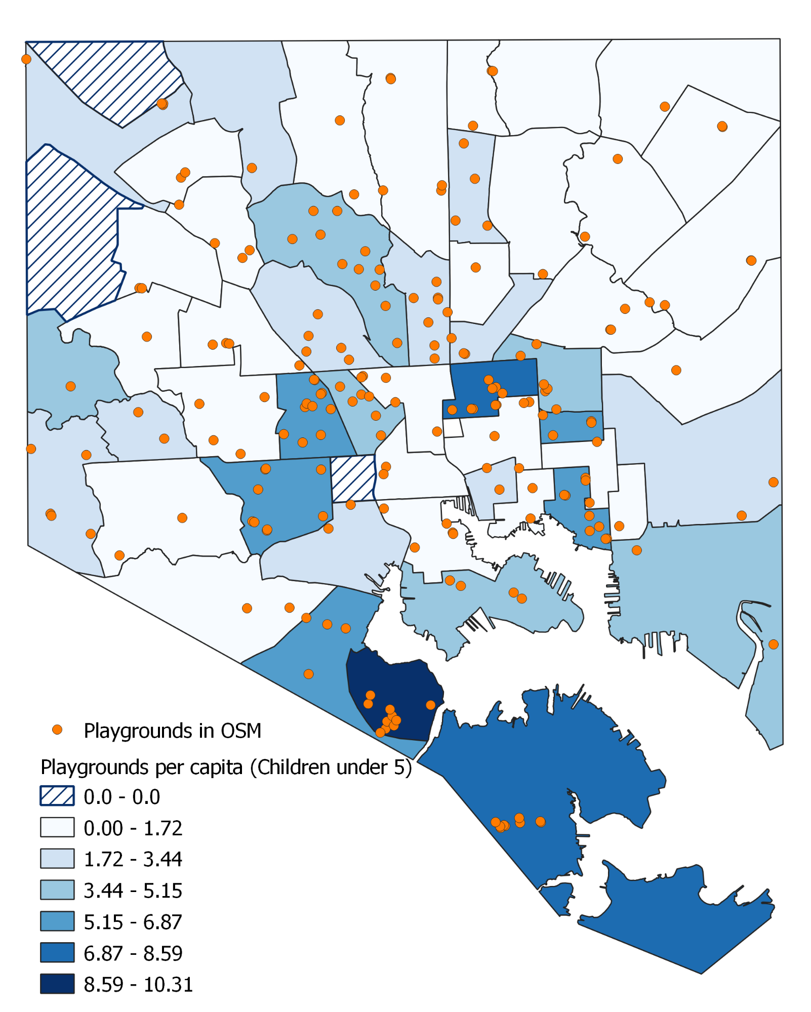
Plotting OSM playground locations against neighborhood population reveals a striking pattern: while some neighborhoods have more than 10 playground features mapped per 1,000 kids under five, many neighborhoods have less than 1 mapped. Population data is reported as per capita population for children under five within neighborhood units from the 2010 Census from the BNIA Vital Signs 17 open data portal. Of course, this doesn’t mean these neighborhoods truly lack playgrounds, it might just mean they are not on the map. With an accurate map of playground location and condition ACY will be able to drive policy and advocacy across Baltimore.
To tackle this problem, ACY is hosting MaptimeBmore for a playground mapathon at their headquarters in downtown Baltimore October 30th. We hope many Baltimore mappers can attend to help add missing playgrounds to the map. Once we have an accurate inventory of the quantity of playgrounds across Baltimore, we can locate “play-deserts”: areas where there are no playgrounds within a safe walking distance of a child’s home (for example ¼ mile, or a 5 minute walk). Play-deserts could be the target of advocacy and outreach to try to have safe playgrounds built or upgraded. In addition, an important next step will also be to update attribute data on playground condition, amenities, and surface type to help understand the quality of playgrounds. October is National Children’s Health Month, focused on reducing exposure to harmful toxins and contaminants. Even if kids have a playground nearby, if the playground has been neglected it might be a harmful source of toxins and contaminants. Accurate maps in OSM of playgrounds with the correct tags (e.g., surface=* grass, sand, rubber, woodchips, etc.) can help provide an inventory of the quality of playgrounds children have access to. For example, a playground with an additive surface might be better than one with bare dirt, but the additive surface might also need maintenance and repair.
Kids need safe playgrounds near their homes, and with OpenStreetMap we think we can help that mission. Join us October 30th at ACY to help map playgrounds in Baltimore, or create a task in the OpenStreetMap Tasking Manager, or go out and map your community. It doesn’t take long to find a park that needs its playgrounds mapped, and then get outside for a quick survey to get accurate tag information. Do it for the children. Happy mapping!
Join the mapping efforts for National Children’s Health Month! If you are interested in supporting playground mapping efforts by hosting a mapathon or creating a mapping task in your town, message team@openstreetmap.us and we can get you started!