This a guest blog post featuring OpenStreetMap community member Steve All on the US Bicycle Route System project. Do you have a story to tell? OpenStreetMap US news or info to share? Message us at team@openstreetmap.us and we’ll work with you to craft a blog post to share with the community!
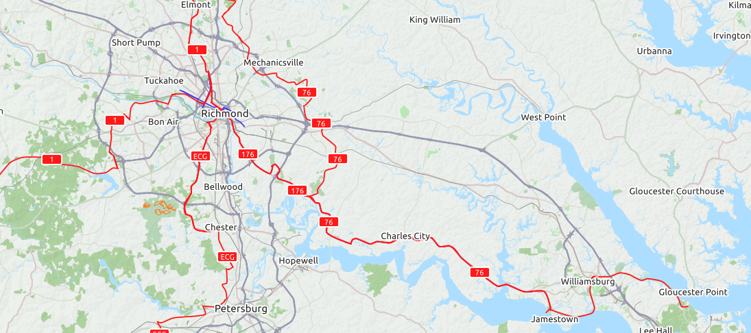
Over the last decade, OpenStreetMap has seen the national cycleway network in the United States blossom into existence. This network is displayed by the OpenCycleMap layer by Andy Allan and other cycling renderers like Waymarked Trails’ mountain biking overlay by Sarah Hoffmann and the newer, still-evolving CyclOSM layer by Phyks and Florimondable. These national bicycle routes display as new red route lines on the Cycle Map layer. But, early in OSM (2009 to 2011 or so), this had become a “messy sandbox” of actual and proposed routes. As many found these confusing, people began talking with one another about the best way to implement and even improve this endeavor going forward.
Between 2011 and about early 2014, there was dialog on the talk-us mail-list, then in emails between an OSM volunteer and a volunteer of the Adventure Cycling Association (ACA) to improve the process of mapping this ever-growing system of routes. The ACA, a grassroots volunteer organization built out of people who long-distance bicycle tour our beautiful country from coast to coast and top to bottom, plays a key role in supporting local and state officials in the process of developing and designating national bicycle routes. Hundreds of emails later, bouncing ideas off of multiple nationwide conversations, after a few trials, better tagging, discussing amongst ourselves and watching as state and national bureaucracies both listened as they stumbled forward but also improved as they learned, the ACA streamlined its process. And in OSM arose a new “WikiProject,” the United States Bicycle Route System (USBRS for short).
For decades, a semi-annual pattern of synchronizing “in the spring and in the autumn” takes place with the American Association of State Highway and Transportation Officials (AASHTO) to manage the numbering of US highways, Interstate highways and US Bicycle Routes as national networks. During these twice annual meetings, AASHTO, largely made of one-of-the-fifty-states Department of Transportation (DOT) staff, also approves newly designated US Bicycle Routes. During 2012 and 2013, OSM and ACA harmonized workflows as this WikiProject, working together to better grow the USBRS in line with these approvals. A talk was given at SOTM-US 2014 in Washington, DC about how OSM was facilitating this by providing highly accurate mapping of correctly intentioned, proposed and newly-approved routes. Despite some initial rough edges and misunderstandings from this about what a “proposed” route actually means, the endeavor wobbled forward. An AASHTO letter granting copyright permission so OSM may use state application route data really helped. Now, OSM has a green light to freely enter route data directly from the state DOT applications to AASHTO for approval. After all, these are the authoritative source of the route data.
As the OSM community paid attention to these national bike routes being developed and submitted, the USBRS within OSM semi-annually grew by a few routes, sometimes several each year. In AASHTO’s Spring round of 2021, an astounding 20 routes were proposed, 18 as new and two as realignments to existing routes, the biggest growth spurt yet. OSM’s honed, patient and practiced process was at-the-ready. A post or two later to the talk-us list requesting help adding route data resulted in volunteers yet again ready to stand up and map! One from Utah, one from Washington state, there were routes in Wisconsin, Maryland, West Virginia, Florida, Arizona, Michigan and other states from earlier years where volunteers said “I’d love to add that USBR to OSM!” And we did.
What happened? In the early 2010s, the OSM community took a couple years to scratch its head and say “hm, what’s going on here, these bike routes don’t look right, how do we make this better?” So, a few people talking to each other turned into a good process that logically mapped well to how it was already being done (ACA works with state DOTs to submit a bicycle route to the national System on AASHTO’s next semi-annual ballot). The wiki developed, established and documented OSM’s workflow: OSM gets the state application (maps, turn-by-turn route data…) and enters the route, while tagging it “state=proposed” (as it remains “only” a state application, not yet approved by AASHTO). This tag denotes “under construction in OSM.” That process is coupled with the submission of new routes by state DOTs to AASHTO becoming a post to talk-us asking “who wants to enter a statewide bike route?” and “take a look at how we do so in the USBRS wiki, please.” And people step up and say “I can do that, I’d LIKE to do that!” Thus, routes in the USBRS get built; the System effectively grows in OSM just as it grows in the real world: state DOTs submit route applications, AASHTO approves them, meanwhile OSM maps them while the routes are “on ballot” with state=proposed, then that tag is removed after approval.
This is crowdsourcing that works, at a state and national level, for bike routes anybody who bikes can use. Route signs are being erected as fast as people can make them and get out there to put them up. Somehow, it all works. People “get it” where they might fit in and add a lending hand, (whether coordinating with county and city road departments, entering routes into OSM, erecting signs with a volunteer crew and shovels with cement…) so OSM as a map has been exploding with red national bike routes for a decade as we do so. OSM displays the CORRECT red routes on our map, because, this is OSM: we have high standards. We want to ideally blend with the best method there is to do this and then do it. So, that’s how we build it. We also listen: how should we improve our process? How can we be more inclusive? What might be future methods to do this even better or communicate more widely that anybody can do this and there is an established process for doing so? As we all throw our shoulders into the effort, we double-check that all is as it should be. To put a number on it, we’re often at around 99% to 100% of both complete and correct — at least until the next semi-annual round begins! Multiple OSM volunteers help each other out, do it right, improve the process, check as we build, look over each other’s shoulders…that gets us to 90%, 95%, 99% and eventually 100%. Both complete and correct, because BOTH are important!
And if you find a small omission of “someone forgot to tag this on-ramp as oneway=yes or role=forward…” well, you can fix it, too, and maybe 99.9% becomes 100% (today, in your state, for that route) and up and up it grows. Both the System and the data in our map. That’s OSM at its best: map and document what’s real, especially as it develops and grows into its full implementation. During the route entry phase, OSM’s USBRS data is a bit of a “construction zone,” but after AASHTO approval and the state=proposed tag is removed from the routes, what we have (and offer to the world with multiple, beautiful renderings) is an accurate, growing map of national bicycle routes. Awesome! Six months later, repeat the process for another successful round.
With good communication among individuals across one community or multiple communities, with the Wiki both instructing and tying together the status of progress, with shared knowledge leveling up newer volunteers to map with better skills, this doesn’t work for just bike routes, it works for everything! You might do this for all the public library branch locations in your city or county. Perhaps you could work with others on entering state parks or county parks. Maybe you endeavor to add all the sports facilities in a community or everywhere you can fish or hike or ride an off-road motorcycle or go camping in the wilderness. OSM has an infinity of opportunities for building community and it is eager for you to discover and implement them!
Interested in meeting fellow cycle mappers? Join the conversation in the OpenStreetMap US Slack in the #bicycle channel.