The 12 Months of OpenStreetMap is an initiative led by OpenStreetMap US, and inspired by the Project of the Month done by map contributors in France, Switzerland, and Germany. The initiative is designed to engage the mapping community and volunteers around a new theme every month.
We’re kicking off 2022 by encouraging the OpenStreetMap US community to map for Mobility & Accessibility as part of the 12 Months of OpenStreetMap.
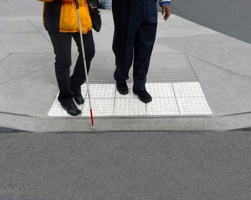
Pedestrian networks are a critical component of transportation infrastructure that can play a key role in transportation equity, accessibility, and community resilience. However, pedestrian networks, including sidewalks, crosswalks, and mobility guidance such as tactile pavers, are too often overlooked and therefore, undermapped. This creates gaps in data for navigation and planning. Mapping sidewalks, crossings, and other parts of pedestrian infrastructure in OpenStreetMap provides data used in routing applications and can be used in advocacy, planning, and policy development. Many organizations and communities are using OpenStreetMap data to advocate for improved mobility and accessibility including the Taskar Center for Accessible Technology (developers of OpenSidewalks and Accessmap).
What you can map
Interested in mapping to support mobility & accessibility in OpenStreetMap? Use this brief guide to get started and what resources to use. Be sure to add #12MonthsofOSM to your changesets in January.
1. Remotely map sidewalks & crossings in your area.
Complete the sidewalk and crossing network for your neighborhood. If your neighborhood is already completed or does not have sidewalks, search for a nearby neighborhood that needs completing.
According to guidance from OpenSidewalks, it is recommended to map crossings BEFORE sidewalks: “We need to add crossing data before we map sidewalks, because mapping sidewalks all by themselves can ‘break’ the map if they aren’t connected to anything! Street crossing provides a means by which sidewalks will be connected to the street network, ensuring that pedestrian data is never in a “broken” state.”
-
To map crosswalks/crossings, add a line down the center of the sidewalk, tagging with highway=footway AND footway=crossing, connect with any existing sidewalks. Crosswalks and sidewalks together should create a navigable network. More information can be found on the OSM Wiki here.
-
To map sidewalks, add a line down the center of the sidewalk, ending at crosswalks and street crossings. Tag with highway=footway AND footway=sidewalk. More information can be found on the OSM Wiki here.
2. Get outside and add information on curb (kerb) cuts to crossing points.
After mapping the sidewalk network in your neighborhood, walk around to survey and map the curb cuts at crossing points. For each crossing point, add tags to an existing node or create a node, add the relevant tag describing the transition. Example tags include kerb=raised, kerb=lowered, and kerb=flush. If tactile paving is present, add tactile_paving=yes. More information can be found on the OSM Wiki here.
3. While you’re out, add wheelchair access information to buildings, businesses and amenities.
Provide critical information to those using wheelchairs or other mobility devices by adding wheelchair=yes or wheelchair=no for amenities and services in your area. More information can be found on the OSM Wiki here.
Looking for more information on mapping sidewalks, curbs and related infrastructure? Check out this fantastic and thorough guide from OpenSidewalks.
Monthly Project
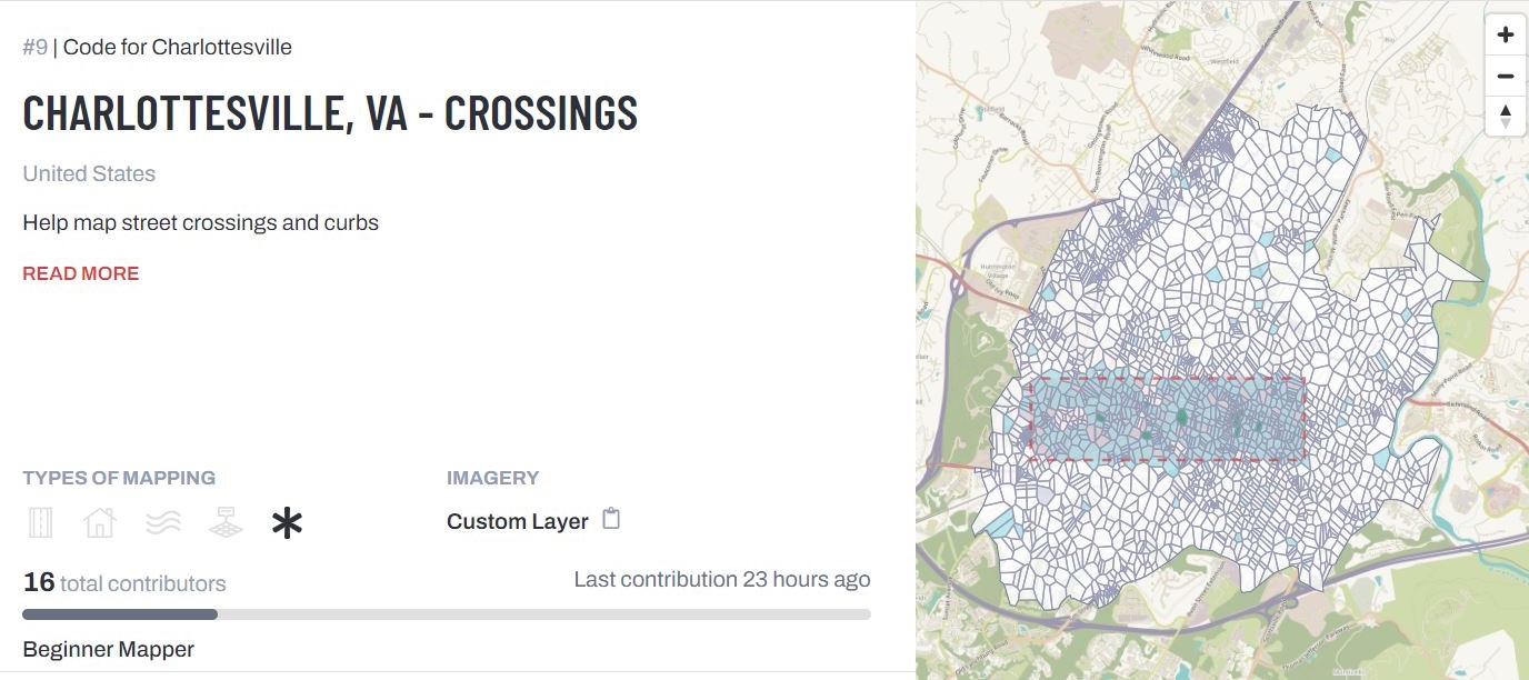
Each month in 2022, we’ll highlight (or set up) a project for the OpenStreetMap US community to gather around and map. This month, check out the OpenSidewalks tasking manager project for crossings in Charlottesville, Virginia. Let’s help Code for Charlottesville reach 100% mapped! Be sure to add #12monthsofOSM to your changesets.
Want to virtually map crossings and sidewalks alongside other mappers? Attend TeachOSM’s Map-Along on January 18th at 8pm ET.
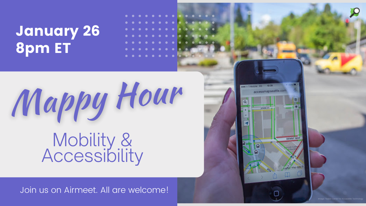
Mobility & Accessibility Mappy Hour
Interested to hear more about the impact of mapping for mobility and accessibility? Nick Bolten of the Taskar Center for Accessible Technology joined us for our January Mappy Hour on January 26 to discuss OpenSidewalks, AccessMap and more! Watch the recording here.
Are we missing any great resources, recommendations or tips on mapping for mobility & accessibility? Email us at team@openstreetmap.us and we’ll do our best to add your expertise here.