Background
You may have seen an announcement in a previous blog post about the existence of the OpenStreetMap US Trails Working Group. This growing collaboration of OSM mappers, land managers and navigational app developers is working to improve the safety of recreationists and protection of the environment by improving the data behind many public trails in response to rising levels of visitation. You can reference some of this proposed work on the U.S. Trails wiki and hear about the work on this episode of the Nowhere podcast, a Mappy Hour about Trails in OpenStreetMap and a presentation by Diane Fritz (link coming soon!) at the State of the Map US.
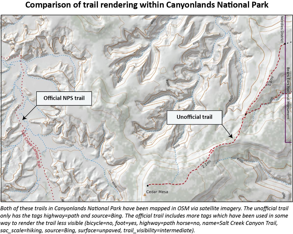
As a reminder from our previous post, sometimes the tagging in OpenStreetMap data leads to imbalances in trail emphasis as seen in the following figure:
The Pilot Project
The next phase of the collaboration is a pilot project to thoroughly map tags in test areas to see how this affects the rendering of trails.
Three different spaces in Washington state have been selected: one in a national park, one in a wilderness area and one incorporating urban areas and parks. These areas were chosen because there are many different trail systems and types of trails that could call for varied rendering styles. Working group participants are familiar with these spaces from differing perspectives (as mappers, land managers, and recreationists). Their local knowledge in assessing the outcomes of the tagging in such a nuanced and diverse area will be great feedback on how the schema is working. In other words, does the data and how it is rendered match what is on the ground?
Here are a number of situations present in the pilot areas:
-
A variety of official trail systems accommodating many different activities such as:
-
Hiker and horse trails in designated wilderness
-
Non-motorized trail systems for walking, hiking, mountain bike riding, and more
-
Motorized trail systems for motorcycles, ATV, UTV, and Jeep,
-
Cross-country ski and snowmobile trail systems
-
-
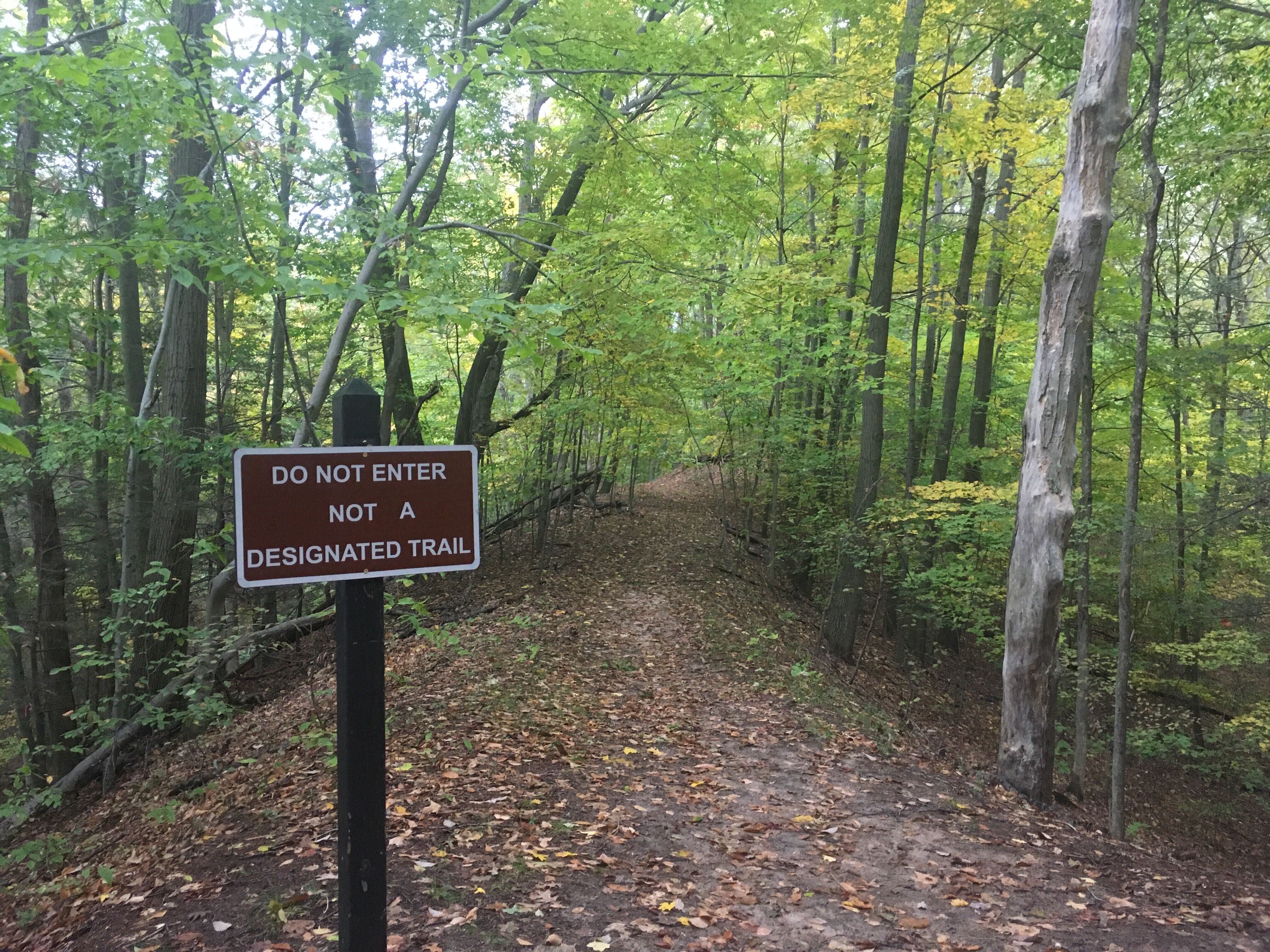
Unofficial trails across many ownerships such as:
-
Social trails leading to popular climbing routes and bouldering areas
-
Unofficial trails used for walking, running, and hiking
-
Illegally built hiking and mountain biking trails- as featured in the ‘Pedal Driven’ movie
-
Motorized trails
-
For this first mapping pilot, those who have been involved in the Trails Working Group will be doing the initial mapping over the next few months to test out the structure of the project (platforms, instructions, etc.) so we have a clear interface when we expand our engagement and this work to include other areas and people from across the US.
We’ll be testing two different platforms, the OSM US Tasking Manager and MapRoulette. The first platform, the OSM US Tasking Manager, can be used to edit trails data in the predefined areas. One great thing about the Tasking Manager is that there is a validation step built in that will provide the possibility for land managers to review edits.
MapRoulette, the second platform, can be used to build mini-tasks so a mapper can specifically be checking tagging on official trails or, conversely, examine the status of untagged trails and do as many edits in a session for which they have time.
We’ll be taking before and after images of how trails are rendered on various platforms, also capturing the data added to OpenStreetMap. The idea is seeing what the results would be of a complete mapping campaign in an area in how the trails appear and are rendered. Some navigational app companies already have rendering rules in place that we feel will immediately improve the maps when trails are fully tagged. For maps or trail scenarios needing improvement, we will suggest companies update their maps according to the tags placed on the ways/trails.
Get Involved!
There are still voices missing from the Trails Working Group! We would love to involve more local land managers, indigenous perspectives, local mappers and hikers, hiking clubs and outdoor enthusiasts as this project moves forward. Please reach out to trails@openstreetmap.us.
Once we complete the pilot and assess the outcomes, we’ll be looking to expand our efforts to work with parks, hikers, and mappers across the country in the coming year. We’ll need help as we go beyond the pilot project and see how this tagging works in different areas, whether we’re trying to reduce use on unofficial trails to save cryptobiotic soil in the desert or we’re keeping folks from getting stranded on scrambling routes in the high mountains.
Open spaces in the US continue to see increased levels of visitors causing an uptick in the use of navigation apps by people exploring new areas. OSM US formed this Trails Working Group to support land management, help keep people out of sensitive or conservation areas, and keep hikers and the lands safe by improving communication channels and the data behind those lines. The process of creating maps can be as important to building community consensus as the maps themselves, so please don’t hesitate to get involved!