
Last week, OpenStreetMap US launched a revamped version of our Tasking Manager, a tool for collaborating on mapping campaigns. The release includes a number of custom features specific to the needs of the US mapping community, notably the integration of Public Domain Map projects alongside OpenStreetMap projects. Here’s a tour.
Public Domain Map
As US law requires government data products to be released in the public domain, agencies have a limited ability to handle ODbL-licensed OpenStreetMap data. This gap deprives the US public and OpenStreetMap mappers from both participating in, and benefiting from, crowdsourced government datasets. Public Domain Map is a toolkit that bridges the license gap by enabling government agencies, NGOs, and other partners to request help from mappers in creating public domain data.
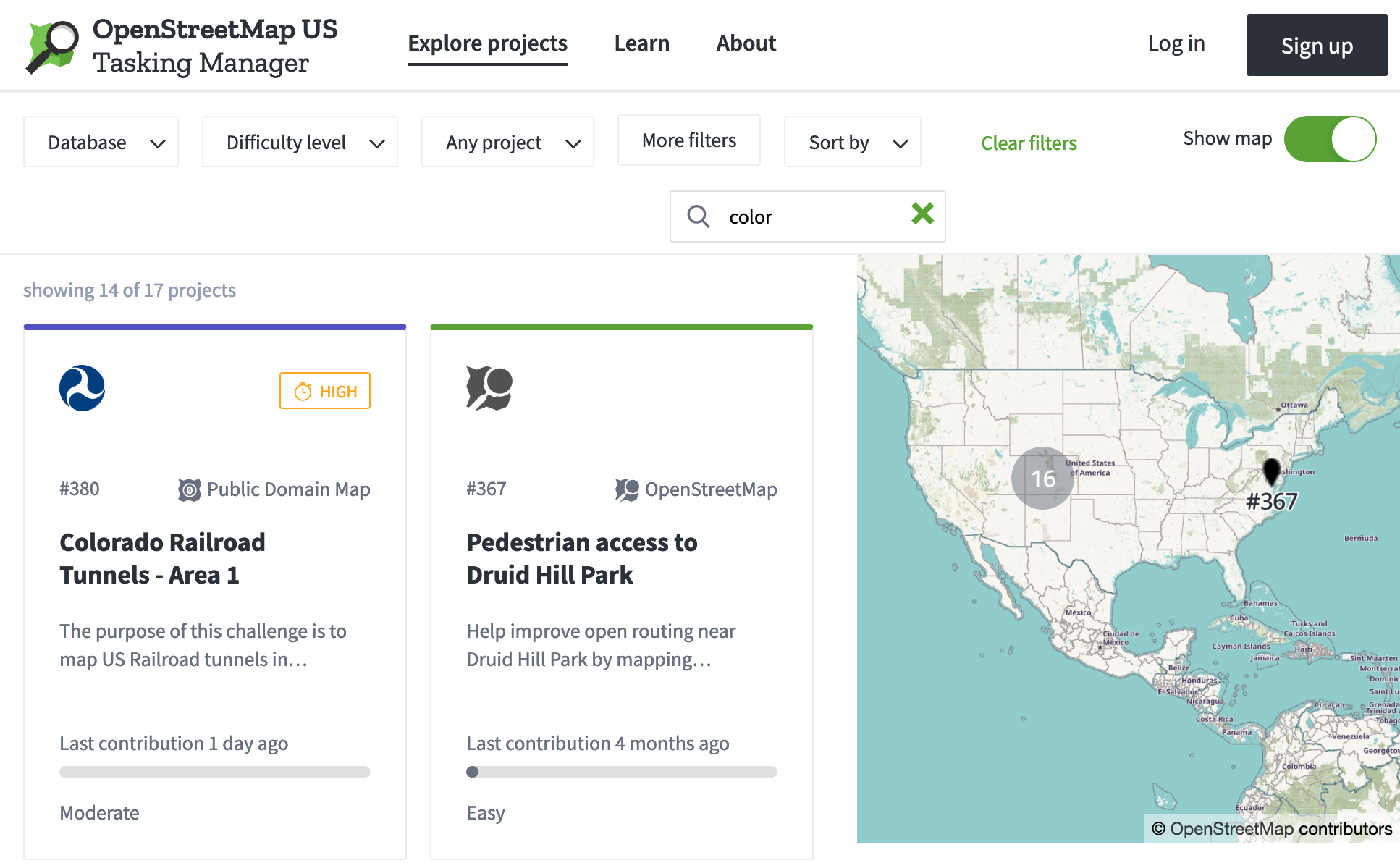
Public Domain Map projects live in the new Tasking Manager alongside OpenStreetMap projects, and are clearly differentiated by color, label, and icon.
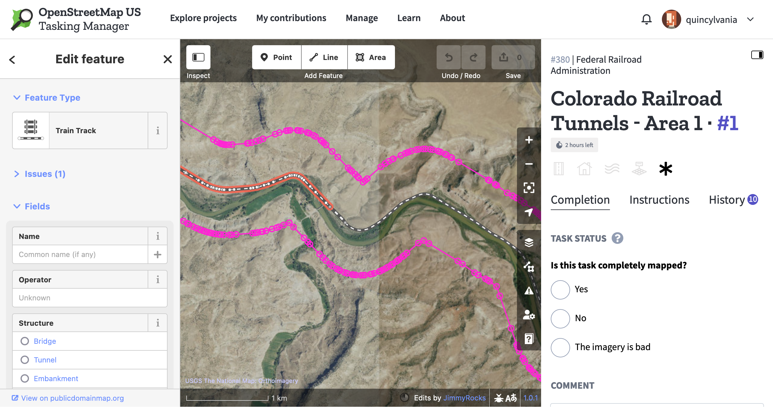
Editing is performed with a custom iD editor that shows only license-compatible imagery. Data is saved to an interim database that is compatible with the rich ecosystem of OpenStreetMap tools. Data validation is performed in the Tasking Manager by our partners to ensure quality with their standards.
When mapping and validation are complete, the data is made freely available for integration into authoritative data products as well as OpenStreetMap.
The Public Domain Map initiative is just kicking off, so keep an eye out for more updates coming soon. Questions? Contact info@publicdomainmap.org.
Redesign
Design sets the tone of a website. Bold yet approachable, professional yet homegrown, fresh yet familiar—these are some of the feelings I was going for in this redesign. By breaking from the default branding, we set the OpenStreetMap US Tasking Manager apart from other TM instances. Mappers can be sure of which tool they’re using and get a sense of why it’s special.
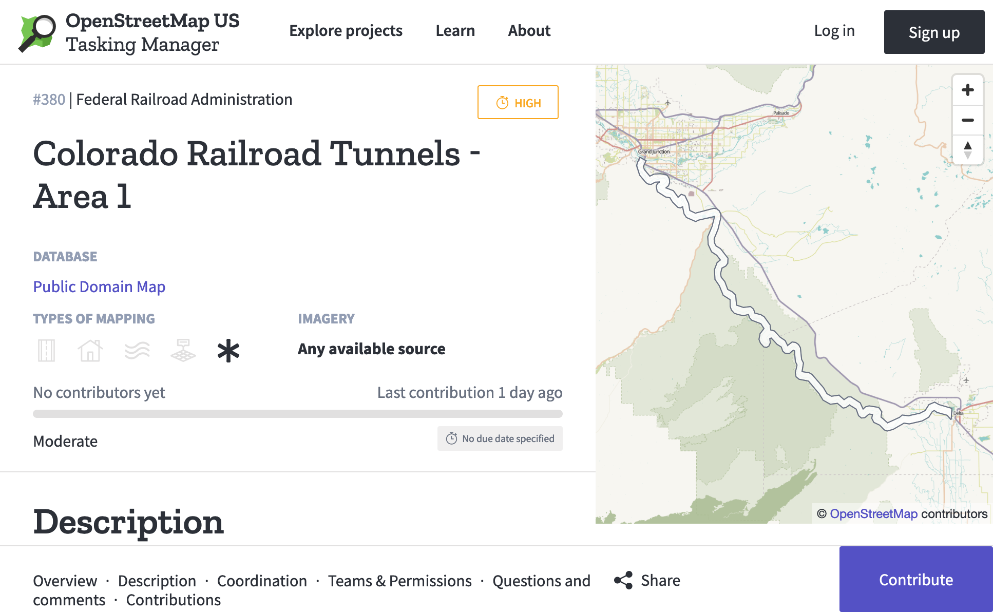
Green is now the main interface color, matching the OpenStreetMap US logo. Public Domain Map projects appear in a special indigo color in order to make their distinction from OpenStreetMap abundantly clear.
We use the Zilla Slab font family for titles and headers. This font looks especially great at large sizes and has a growing history in open source projects. All other text is set in Source Sans, a workhorse font suitable for everything from tiny button labels to beefy paragraphs. I think the two fonts make a swell pairing. All-caps text has been significantly reduced, resulting in a friendlier vibe.
Acknowledgements
Many thanks to the Public Domain Map steering committee for patiently shepherding this project to fruition. Thanks also to Jim McAndrew for putting together the original version of this tool and for maintaining the backend, as well as to Ian Dees for his assistance in deploying this update. Lastly, our eternal gratitude to the Humanitarian OpenStreetMap Team for building and maintaining the HOT Tasking Manager, the open source project underlying the OSM US Tasking Manager.
Get involved
The OSM US Tasking Manager is an open source project that welcomes participation on GitHub, where you can report bugs, request features, and contribute code.
There are well over 100 projects over on tasks.openstreetmap.us set up by people requesting help from the mapping community. I invite you to head on over, check out the redesign, and find something impactful to map.