The 2007–08 TIGER import was infamous for its roads, but did you know it’s also the source of most of OSM’s railroad coverage in the U.S.? TIGER kept roads and railroad tracks in separate GIS layers, so they got imported as completely disconnected sets of features, whereas OSM expects highways and railways to connect when they physically intersect. Every railway=level_crossing and railway=crossing node in OSM today is the result of mappers taking the time to connect the features together, often while making other improvements.
Back in 2015 and 2016, Martijn van Exel and Mike N. set up some of the first MapRoulette challenges in order to map railroad crossings. They used authoritative crossing data from the Federal Railroad Administration (FRA), later supplemented by a query of where OSM highways and railways intersected, to be even more thorough. A number of mappers worked together on these challenges for ten months, finishing in August 2017. Since then, mappers have been busy adding other details such as crossing gates and FRA IDs.
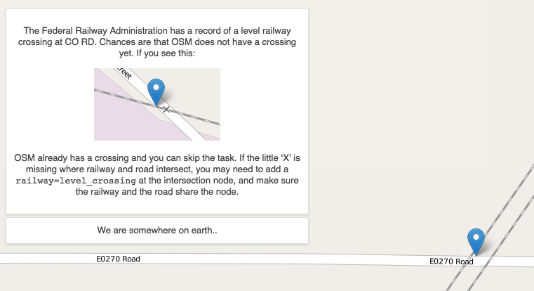
One of MapRoulette’s earliest challenges asked mappers to add railroad crossings. (© 2015 Martijn van Exel, CC BY-NC-SA 2.0)
Many of us mappers would be pleased enough to know that these improvements get our corner of the map closer to completion and better aligned with OSM’s tagging standards. But there’s a real-world benefit too. Based on the data we’ve curated, turn-by-turn navigation experiences in OsmAnd, Mapbox, and others are now able to show and sound alerts about upcoming railroad crossings to users who might otherwise overlook these hazards.
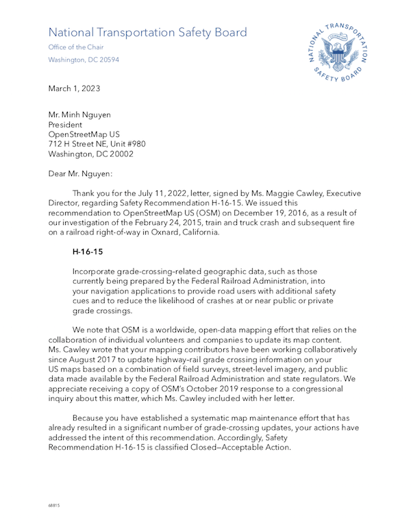
These data and software improvements align with a recommendation that the the National Transportation Safety Board (NTSB) issued to a number of companies and organizations, including the OpenStreetMap Foundation, represented by OpenStreetMap U.S., following a 2015 collision. Regulators are understandably interested in technology’s role in the thousands of highway–rail crossing incidents that occur annually across the country, but also in potential mitigations. Last week, the NTSB sent OSMUS a letter affirming the community’s efforts and officially closing the case for OSM. We appreciated this opportunity to explain OSM’s role in promoting rail safety.
However, the work doesn’t end here. At-grade crossings are frequently reconfigured or eliminated, requiring constant upkeep. Private driveway crossings are often more obscure than public crossings, with a stop sign at most, but they can still pose a safety risk to the public. Quiet zones have unique safety considerations that would be addressed by a draft tagging proposal, already being applied informally. Plenty of bridges and speed restrictions remain untagged. How should a queue-cutter signal be tagged anyways?
.jpg)
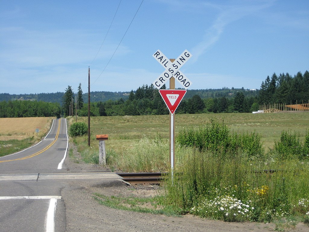
A private crossing in Oregon has a stop sign and regulatory sign but no gate, lights, or warning sounds. (© 2003 Oregon Department of Transportation, CC BY 2.0)
As with trail stewardship, rail infrastructure is one more area where the community can work hand in hand with data consumers and regulators to make a difference. If you’re looking for a simple way to get involved, try one of the rail-related challenges currently in progress on MapRoulette (search for “rail”). Thanks to all the railfans out there for your attention to detail, and keep up the good work.
Minh Nguyễn is our outgoing board president. Do you have a story to tell? OpenStreetMap US news or info to share? Message us at team@openstreetmap.us and we’ll work with you to craft a blog post to share with the community!