OpenHistoricalMap and YouthMappers have a new Charter Project friend: Yesterdays!
What is Yesterdays?
Yesterdays is a website where volunteer contributors georeference historic images of their city, co-creating a map of what their community looked like across time. The project began in Richmond, Virginia, where the Charter Project Advisory Committee is based, and is beginning to gain traction across the United States with communities emerging in Cincinnati and the Inland Empire.
Contributors draw from photographs imported from local libraries and museums and assign each image a physical location based on information from OpenStreetMap, OldInsuranceMaps.net, and primary sources. Yesterdays is a tool for education, community engagement, and an accessible entry point into the world of OpenStreetMap and open data.
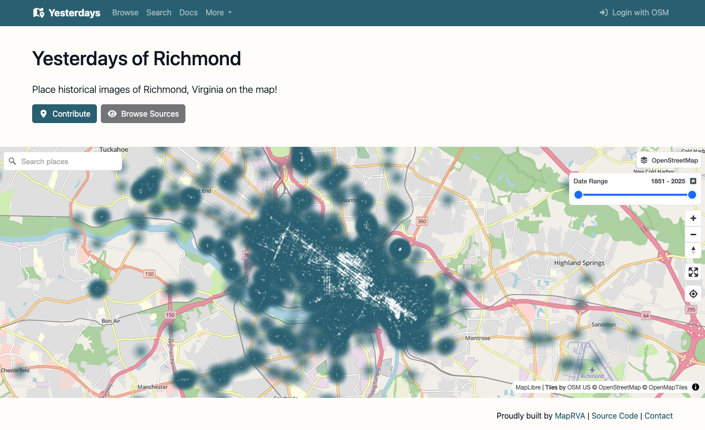
A screenshot of the Yesterdays of Richmond homepage showing the density of images georeferenced.
What does it mean to be a Charter Project?
OpenStreetMap US launched the Charter Project program back in 2020, with the goal of supporting innovative and indispensable projects in the OpenStreetMap ecosystem. Since then, we’ve had the opportunity to welcome YouthMappers last year, support OpenHistoricalMap for almost 5 years, and host OSMCha and MapRoulette as they grew to become full programs of OSM US with dedicated staff support.
For Yesterdays, being a Charter Project means that…
-
You can now donate to Yesterdays through OSM US, a 501(c)(3) charitable organization, meaning your contributions are tax deductible in the United States.
-
The project can share their work through OSM US channels, including promotion at our conferences and on our website.
-
The project can take advantage of OSM US’s legal and financial framework, providing a space for it to grow sustainably.
OSM US is thrilled to support a platform that builds on the power of crowdsourced projects like OpenStreetMap. Yesterdays provides a welcoming and intuitive way to engage with open data, showing the potential of what can happen when you combine OpenStreetMap with local knowledge and histories.
It has been a pleasure to watch Yesterdays grow so quickly, bringing together mapping and history enthusiasts in the Richmond area. We are eager to partner with OpenStreetMap US to help secure sustained success for Yesterdays, and work with this community to launch instances of Yesterdays in other regions around the country.
We can’t wait to see what’s next for Yesterdays!
Get involved with Yesterdays
-
Join the discussion in the #yesterdays channel on the OpenStreetMap US Slack
-
Check out the source code on GitHub
-
Keep an eye out for Yesterdays instances popping up in cities around you
Any project in the OpenStreetMap ecosystem is invited to apply to become a Charter Project; applications are always open and reviewed on a rolling basis. Visit the Community & Charter Projects page to learn more.