OpenStreetMap US

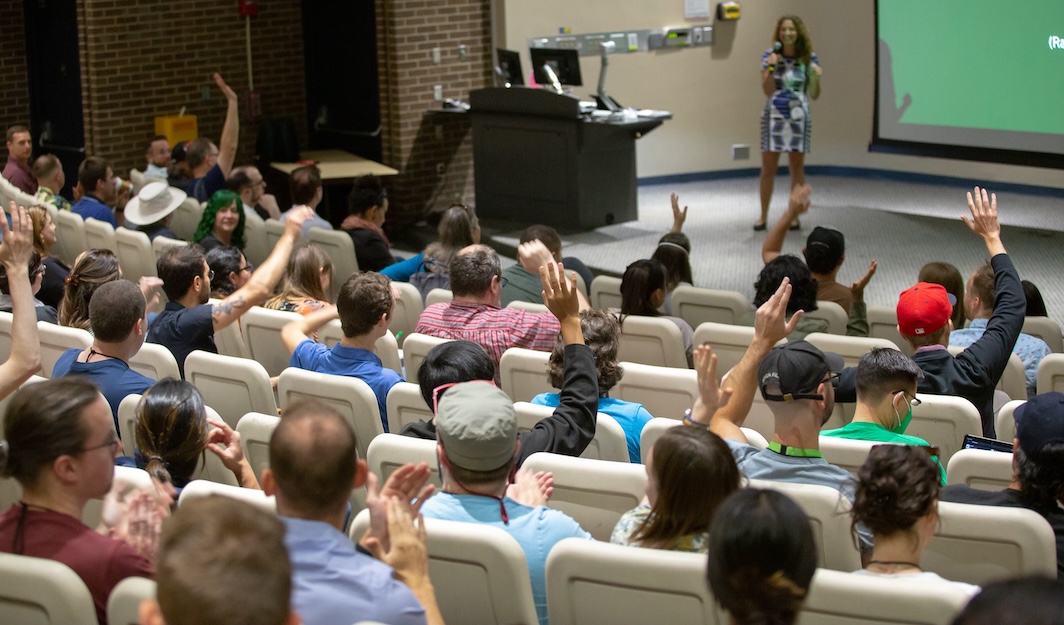
First-time attendees at SotM US 2023. Photo by Parker Michels-Boyce.

OpenStreetMap US hosts a variety of events throughout the year to bring together and grow the OpenStreetMap community in the US. This page only lists events that are organized by OpenStreetMap US. Local communities independently organize many events throughout the year! Have a look at the OSM Calendar to find them.

Upcoming events

SliceOSM Community Project: download the freshest OpenStreetMap data!

Jan 24, 2025 · Brandon Liu and Jake Low

SliceOSM is a new OSMUS community project! This web service is the easiest way to download up-to-the-minute data for any custom area. Come see how it is made, and how to get...
OSM Merge Community Project

Jan 24, 2025 · Rob Savoye

Conflating external datasets into OpenStreetMap.
Charting the Woods of West Virginia and Beyond

Jan 24, 2025 · Attila Kun

Discussing the updates, challenges and outlining future plans regarding mapping woods for Eastern USA in OSM.
Data exploration with filterable maps - WAMap

Jan 24, 2025 · Matthew Whilden

Applying full data vector tiles and a basic filtering UI creates an instantly responsive Overpass experience without all the syntax and ceremony. https://watmildon.github.io/TIGERMap/WAMap/
Open Street Level imagery for US with Mapillary

Jan 24, 2025 · Said Turksever and Alyssa Castronuovo

Mapillary is on the way to 3 billion images by 2025. Partnering with OSM US, we’re expanding coverage across the US. Join us to explore Mapillary’s tech, mission to map every street...
Share your first OSM edit - now with AI!

Jan 24, 2025 · Martijn van Exel

Remember your first OSM changeset? Wasn’t it exhilarating? Something you would want to share with the world! I wanted to make it easier for mappers to do just that and made an...
Using OpenStreetMap data to Map Critical Infrastructure During Disasters

Jan 24, 2025 · Rachel Stevenson

This presentation will discuss how Emergency Managers can Use Open Street Map Data, to Identify and Map the 4 Critical Lifeline sectors that impact all of society.
Pedestrian Working Group Update

Jan 24, 2025 · Jacob Hall

Since its formation in March 2024, the Pedestrian Working Group has brought together community members interested in mapping pedestrian infrastructure in the U.S. to develop common goals.
Meta-YouthMappers Walkabout Project

Jan 24, 2025 · Alex McDonald and Chad Blevins

This collaboration between GW YouthMappers and Meta is expanding across the US! Students trace and validate pedestrian features into OSM, while developing their skills and building community.
Where to Map? for Community OSM Projects

Jan 24, 2025 · Jennifer Miller

You’re doing a community mapping project! Now, what area will you map? This talk presents a decision-making method called the criteria-alternatives matrix to help your group make a good choice.
Building Map Ready Pedestrian Data

Jan 24, 2025 · Yunzhi Lin

What features should be included on a map to enhance safety and efficiency for pedestrian navigation? This talk will explore methodologies for generating and ensuring the quality of pedestrian data.
Developing Skyway, an OpenStreetMap data conversion tool

Jan 24, 2025 · Jacob Hall

Skyway is a new tool for converting OpenStreetMap data between common formats. In this talk I’ll discuss what I’ve learned in the process of developing it, and the plans I have for...
Rising Waters, 3D Worlds: Cesium-OSM-Powered Flood Simulations

Jan 24, 2025 · Michael Mann and Joy Mann

We showcase a flood simulator using Cesium’s 3D OSM tiles and dynamic water modeling, visualizing sea-level rise scenarios for immersive, interactive exploration of real-world flood impacts.
Imports - Three Tips for Working With Open Data

Jan 24, 2025 · Ben Coleman

This presentation will share three tips for working with license-compatible open data, including strategies for profiling and exploration, validation, and advocating for more open data to be shared.
Goodbye Daylight, Hello Overture: Migrating from one QA'd OpenStreetMap distribution to another

Jan 24, 2025 · Jennings Anderson

Daylight v1.58 was the last. However, the QA and validation processes have not gone away. Today, all of the same high quality OSM data is available as GeoParquet in the Overture base...
Making maps with Ultra

Jan 24, 2025 · Daniel Schep

In this talk I will introduce Ultra, Née Overpass Ultra, and demonstrate it’s capabilities. I will also compare & contrast it to other tools such as Overpass Turbo, geojson.io, and Maputnik.
CycleOSMData - A Python Package to Extract Structure Bicycle Infrastructure Data

Jan 24, 2025 · Daniel Patterson

CycleOSMData is a Python library for extracting bike infrastructure data from OSM PBF files. It pulls data on both sides of roads, detailing cyclist protection levels to support safe urban planning.
Workshop: Charting the Woods of West Virginia and Beyond

Jan 25, 2025 · Attila Kun

In a follow-up to his Friday talk, join Attila Kun for a demonstration and discussion of forest landcover mapping.
Underground Truth: How to Map a Pipeline

Jan 25, 2025 · Clay Smalley

How many pipelines are in your backyard? Uncle Sam knows! Learn how to leverage government data to map missing fossil fuel pipelines on OSM.
OpenHistoricalMap Office Hours

Jan 25, 2025 · Minh Nguyễn

Join the OpenHistoricalMap community for our annual informal office hours. Get advice from fellow mappers, brainstorm some focus areas for the coming year, and give feedback to the OHM advisory group.
Organize and analyze OpenStreetMap data using PostGIS and QGIS

Jan 25, 2025 · Sean Whitcomb

OpenStreetMap isn’t just a map - it’s a massive database of geographic information. Learn how to organize, analyze, and visualize OSM data using PostGIS and QGIS software. If participating, please try to...
State of the Map US 2025 Info Session

Jan 25, 2025 · Sean Whitcomb and Clay Smalley

Thinking about participating in State of the Map US 2025 in Boston? Come ask questions and brainstorm ideas for sessions.

Our event series

State of the Map US

The annual State of the Map US conference is the largest gathering of OpenStreetMap community members from across the country. Come meet the people who create, analyze, and use OpenStreetMap with several days of talks, workshops, and social events. It’s the best party in mapping.

Mapping USA

Mapping USA is a virtual conference series run by OpenStreetMap US. It’s a super-accessible event featuring a few days of talks, workshops, mapping parties, networking, and all things OpenStreetMap. Attend from anywhere!

Mappy Hours

The OpenStreetMap US Mappy Hours are virtual hangouts for the U.S. community. We often have guest speakers and they are always an opportunity to meet fellow mappers and talk about OpenStreetMap.

OSMGeoWeek

OpenStreetMap Geography Awareness Week is an annual celebration of open mapping that takes place each November. OSM community members host in-person and virtual events to showcase the power of crowdsourced mapping and invite new mappers into the fold.

Talk archive

Recorded Talks

OpenStreetMap US events feature talks from community members with specialized knowledge on a staggering range of topics. Recorded talks are a great way to learn OSM for beginners and experts alike.

Thank you to our event sponsors

Platinum Sponsors — State of the Map US 2024

  • Esri logo
  • Meta logo
  • Microsoft logo

All conferences