OpenStreetMap US

June 6–8, 2024

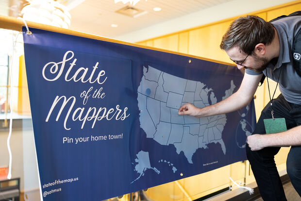
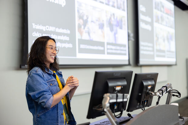
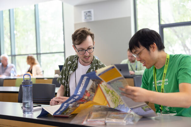
OpenStreetMap US hosted the 12th annual State of the Map US conference along the Wasatch Front in Salt Lake City, Utah.

The Best Party in Mapping

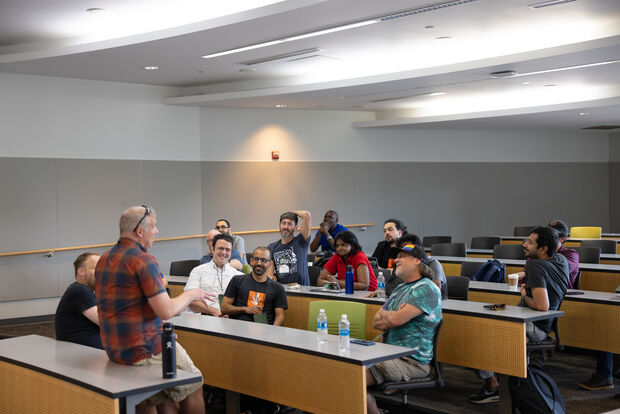
State of the Map US is the largest gathering of OpenStreetMap and open mapping community members from across the country. This year we’re celebrating our public lands with the theme “The Great Outdoors” (though you can expect many other topics too!) There will be two days of talks and workshops, and three nights of social events.

Come connect with other mappers, businesses, academics, government agencies, and nonprofits, all collaborating around the free and editable map of the world. Share your vision for the project, learn how to work with OpenStreetMap data, and hack on the latest open source tools.

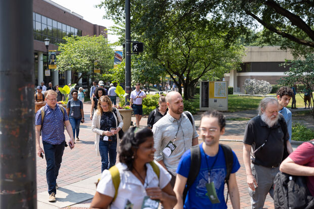
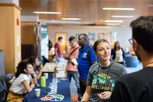
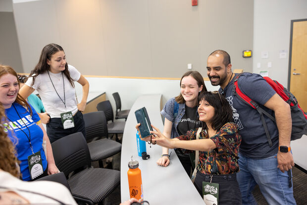
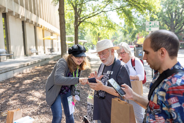
Whether you’re brand new to open mapping or you’re an OpenStreetMap veteran, State of the Map US is for you. We’re excited to see you in Utah.

See our logistics page for lodging deals, transport information, and the conference map.
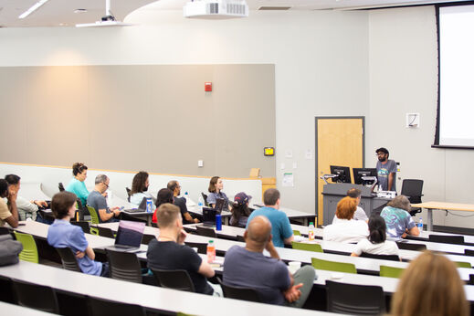
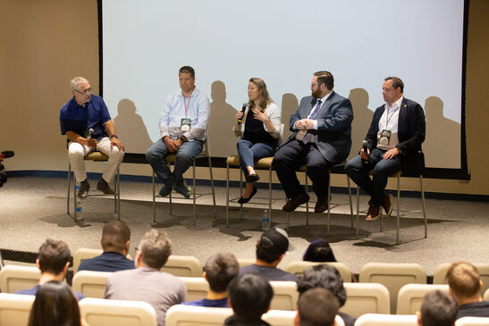
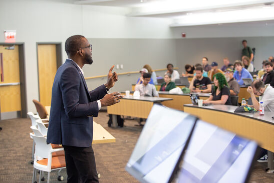
Conference Schedule


  • Thursday, June 6: Welcome social event from 5–10pm at Church & State in downtown Salt Lake City.
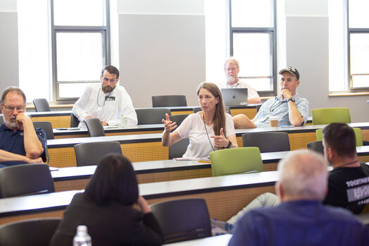
  • Friday, June 7: Conference from 8:30am–5pm at the University of Utah. Evening scavenger hunt around the city
  • Saturday, June 8: Conference from 8:30am–5pm at the University of Utah. Social event from 7-10pm at the Utah Museum of Fine Arts
  • Sunday, June 9: No conference activities—get outside and explore!

The detailed schedule is available in the Whova conference companion app. Attendees can also use Whova for digital networking, discussion, and event planning.

Talks

Welcome to State of the Map US 2024!

Jun 7, 2024 · Maggie Cawley and Martijn van Exel

Maggie Cawley, Executive Director of OpenStreetMap US, opens the State of the Map US 2024 conference. Martijn van Exel, a mapper and developer living in Salt Lake City, welcomes the OpenStreetMap community...

Perspectives from the Trail: Open Data & Responsible Recreation

Jun 7, 2024 · Pitt Grewe, Elizabeth McCartney, Brian Riordan, Kerry Shakarjian, and TJ Broom

This panel discussion explores the intersection of open data, trail mapping, and responsible recreation. We will discuss current successes, challenges, and opportunities related to trail data sources, interoperability, and the goal of...

OpenStreetMap US Trails Stewardship Initiative: Overview & Updates

Jun 7, 2024 · Maggie Cawley, Diane Fritz, and Jake Low

An overview session on the OSM US Trails Stewardship Initiative and Utah mapping campaign.

Getting to know the new Rapid Editor

Jun 7, 2024 · Bryan Housel

Rapid is an advanced editing tool for OpenStreetMap - easy enough for beginners to use, but powerful enough to work in the most densely mapped places. Since releasing the WebGL powered Rapid...

Cooperative Positioning for High Fidelity Field Mapping in OpenStreetMap

Jun 7, 2024 · Sean Gorman

One of the biggest limitations of OSM mapping in the field is the accuracy of GNSS to mark the location of features. For this session we will share new approaches for improving...

State of the OpenHistoricalMap 2024

Jun 7, 2024 · Jeff Meyer, Minh Nguyễn, and Richard Welty

This session will provide an overview of the health of the OpenHistoricalMap project, as measured by active user growth, data contributed, supporting systems that are in place, as well as by reviewing...

Cycling Routing Derived from GPS Traces using OpenStreetMap Tags and Municipal Data

Jun 7, 2024 · Reid Passmore

Cycling networks in the US are often disconnected, requiring cyclists to detour substantially to access safer routes. These routes, while often known by experienced utilitarian cyclists, are not known to people new...

Mapping canoe and kayak trails in OpenStreetMap

Jun 7, 2024 · Quincy Morgan

Did you know you can paddle from New York to Maine entirely on inland waterways? There are thousands of miles of canoeable waters in the United States, but they can be difficult...

Building Utah’s Outdoor Recreation Asset Database using OpenStreetMap

Jun 7, 2024 · Jordan Smith

We highlight the development of Utah’s Outdoor Recreation Asset Database, a repository of spatial data related to outdoor recreation assets managed by federal, state, and local governments within Utah. The database draws...

Standardizing OpenStreetMap Pedestrian Networks

Jun 7, 2024 · Nawin Saravanan Kumaresan and Daniel Hunsaker

ADA-compliant routing in OpenTripPlanner can be significantly improved by standardizing and simplifying OSM pedestrian networks. We show the benefits of breaking the network into logical navigable links with appropriate tags for use...

Utah Politics - GIS in Political Redistricting

Jun 7, 2024 · Jessie Pechmann

In 2018, Utah voters passed a ballot initiative that changed the decennial redistricting process for the state, and the Utah Independent Redistricting Commission was formed. The UIRC reached out to the GIS...

OpenStreetMap Data Supporting Mapping in Transit Environments

Jun 7, 2024 · David Figueroa

This talk will discuss the (San Francisco) Bay Area Metropolitan Transportation Commission’s work evaluating the feasibility of using OSM to support a new program of regional wayfinding information. These maps will be...

Event Mapping: new territory for OpenHistoricalMap

Jun 7, 2024 · Richard Welty

Experimentation has started on mapping events in OpenHistoricalMap. Potential subjects include the routes of explorers and their expeditions, and mapping battles and campaigns. We will discuss available resources, static elements (traditional mapping),...

Update: Pedestrian Working Group

Jun 7, 2024 · Chad Blevins

In March of this year OSM US launched the Pedestrian Working Group to create a space for individual mappers, academic institutions, private companies and government agencies to discuss pedestrian needs, challenges, current...

Lines vs Lanes: Modeling lane fan out in OpenStreetMap

Jun 7, 2024 · Kuan Butts

Complex routable areas like toll booths and border crossings present challenges when modeling in OSM. This presentation discusses the costs and benefits of various approaches, with an eye towards traffic representation and...

The Updated TIGER Battlegrid

Jun 7, 2024 · Ian Dees

The TIGER import kick started the map in the US, but the majority of that data remains untouched. To make finding these untouched areas easier, Martijn van Exel built the “TIGER Battlegrid”...

OpenTrailMap

Jun 7, 2024 · Quincy Morgan

The Trails Stewardship Initiative is a project of OpenStreetMap US focused on improving OpenStreetMap trail data quality in support of responsible recreation. Pilot campaigns have shown the need to improve trail mapping...

Streamlining Data Quality Check for Pedestrian Map Data on OpenStreetMap

Jun 7, 2024 · Yunzhi Lin and Said Turksever

An innovative and streamlined approach to ensure data quality enhancement for pedestrian map data on OSM, utilizing the MapRoulette challenge framework and community activation.

Scalable and Accelerated AI Mapping for Connected Pedestrian Pathways Graphs

Jun 7, 2024 · Cy Rossignol

Mapping pedestrian pathways on OSM can be challenging, requiring extensive data and effort. To address this, we developed PROPHET, an AI pipeline, that utilizes aerial imagery, existing street data, computer vision, and...

Panel: From Open to Governed: Curating official data

Jun 7, 2024 · Elizabeth Sall, Nisar Ahmed, Greg Bunce, Derald Dudley, and Erin Lesh

A shared discussion among panelists and the audience on the purpose and merit of various degrees of “officialness” OSM data verification. The goal of this discussion is to come away with a...

Eight Stories High, Comically Lo-Res, Visible for Twenty Miles: Spiraling Maps Atop Salesforce Tower

Jun 7, 2024 · Eric Theise

Since 2022 I’ve given 30+ performances of A Synesthete’s Atlas—during which I manipulate projected OpenStreetMap-based maps in collaboration with musicians—across North America. My animation, If Map #5, appeared throughout February on the...

Transforming Data into Policy: How We Use OpenStreetMap to Understand Global Development Finance

Jun 7, 2024 · Sheng Zhang and Jacob Hall

AidData maintains the most comprehensive dataset on Chinese-financed development projects, tracking 20,985 projects between 2000 and 2021 worth $1.34 trillion, including geospatial data from OpenStreetMap. Our dataset for 165 low- and middle-income...

A behind-the-scenes look at OpenStreetMap mapping: It’s not all about data production

Jun 7, 2024 · Levente Juhász

Communities are vital to OpenStreetMap. Data quality has been studied widely but OSM goes beyond just data. I explore and analyze mailing list and wiki activity to gain insights beyond just spatial...

HOT Technology, on overview of where we are today and our ambitions for tomorrow

Jun 7, 2024 · Leen D’hondt and Paul Uithol

Part of HOT’s mission is to collaboratively build open and ethical mapping technology accessible to communities around the world, enabling positive change with map data. We will share where we are on...

Using MapRoulette to Strengthen Communities

Jun 7, 2024 · Martijn van Exel

MapRoulette is the premier OSM platform to complete small mapping tasks. Mappers have made millions of map improvements in MapRoulette’s 12 year existence, improving the map in areas such as schools, road...

Reconciling GNIS data and OpenStreetMap with RecoGNISer

Jun 7, 2024 · Matthew Whilden

USGS maintains an enormous collection of data features in the United states in the Geographic Names Information System. Much of this was imported long ago but GNIS has improved in data quality...

Site mapping in OpenStreetMap for print cartography in Acadia National Park

Jun 7, 2024 · Guthrie Alexander

Using the visitor information handouts at Acadia National Park as a case study, this session will illustrate a cartographic design process that simultaneously builds value for OSM and the the Park Service....

Mapping Regulatory Attributes to OpenStreetMap

Jun 7, 2024 · Jonathan Huihui

Effective route risk mitigation hinges on understanding possible hazards, threats, and regulatory restrictions. While risk mitigation to the shipment is primarily concerned with shipment security, government regulations limit the routes for specific...

Mapping and identifying people-first streets in Salt Lake City

Jun 7, 2024 · Troy Saltiel

Cities throughout the world are redesigning streets to better accommodate activity and transportation outside of a private automobile, sometimes referred to as “people-first” streets. This includes adding park space, wider sidewalks, bike/transit...

Mapping the Tracks: Promoting OpenStreetMap at the World's Largest Miniature Railroad

Jun 7, 2024 · Nancy Devine and Harrison Devine

A case study in using OpenStreetMap data to replace proprietary geographic information for a small organization. We will cover introducing OSM to leaders and integrating the data into the organization. The ultimate...

OpenStreetMap for Education: The State of TeachOSM 2024

Jun 7, 2024 · Steven Johnson

How is OpenStreetMap being used in education? This overview of recent advances made in putting OpenStreetMap in school, as well as ways you can help educate the next generation of mappers.

What's New at OpenStreetMap US

Jun 8, 2024 · Maggie Cawley and Quincy Morgan

Hear the latest updates from the OSM US team on programs, events, tools and more!

Keynote: The Power of Participatory GIS in the Management of America's Public Lands

Jun 8, 2024 · Jordan Smith

Participatory GIS has had an immeasurable impact on how we think about, explore, and manage public lands in America. The presentation shares stories of how volunteer cartographers, who were in many cases...

Building a Local Group Website Using Dogwood

Jun 8, 2024 · Jacob Hall

MapRVA is a local group of OpenStreetMap contributors in Richmond, VA. We are eager to expand our reach and take on increasingly ambitious mapping projects in our city. To support these efforts,...

Usage Trends of OpenStreetMap Data in the Humanitarian Sector

Jun 8, 2024 · Jessie Pechmann

OpenStreetMap’s global growth has established OSM as a go-to data source. But what datasets are the most popular from OSM? What crowdsourced data has been the most useful in the landscape of...

Assessing urban park quality using OpenStreetMap data

Jun 8, 2024 · Sean Whitcomb

Urban parks provide a number of ecological and social benefits to residents, but marginalized populations often have limited access to nearby parks. I plan to assess the quality of urban parks in...

The Teenage Mapper

Jun 8, 2024 · Liam McGee

I am kechan, a mapper from the college town of Laramie, Wyoming. I am here to just talk about my history of a mapper. The kicker is that I am 15 years...

One Year of SmallTownBot

Jun 8, 2024 · Matthew Whilden

What if we posted one unmapped town a day on Mastodon? This presentation explains the genesis of SmallTownBot, recaps the conversations driven by it, and presents data about mapping progress in the...

Not just a pipe dream: scaling up OpenStreetMap validation

Jun 8, 2024 · Marc Farra and Wille Marcel

This talk introduces the new OpenStreetMap data pipeline that has been built for OSMCha and has now been migrated to the OSM US organization. We will talk about real-changesets, one of the...

Getting outside is easier when OpenStreetMap and Maxar’s satellite imagery are combined

Jun 8, 2024 · Josh Winer

Heading into the Great Outdoors unprepared can be a risky choice. With the mapping efforts of the OSM community, who leverage Maxar Intelligence’s high-resolution satellite imagery, off-grid and urban enthusiasts alike can...

Taskar Center For Accessible Technology (TCAT) "Responsible Data Science in Urban Spaces" Course

Jun 8, 2024 · Cy Rossignol

TCAT at the University of Washington offers a course, “Responsible Data Science in Urban Spaces,” teaching highschool and undergraduate students GIS software and data ethics. Using OSM data and TCAT’s Walksheds tool...

The Walkabout project: Meta’s efforts to map America’s sidewalks and crosswalks

Jun 8, 2024 · Edoardo Neerhut

Meta’s mapping teams have been working with local communities throughout the United States to map sidewalks and crosswalks in OSM. Significant progress has been made in D.C., NYC, Phoenix, and Austin, with...

OpenStreetMap Network Verification using Ground-Level Video and Aerial Orthoimages for Pedestrian Ways

Jun 8, 2024 · Daniel Hunsaker and Nawin Saravanan Kumaresan

OpenStreetMap users often upload pedestrian network data into OSM; however, the quality of pedestrian ways and associated tags can be highly variable. This presentation will showcase a variety of technologies, including the...

Perspectives from the Trail: Land Management in the Era of Blue Dots

Jun 8, 2024 · Keri Nelson, Larry Velarde, and TJ Broom

Join us to hear from trail management experts as they discuss the challenges and opportunities arising from feature-rich map-centric apps on mobile devices. These apps have transformed how we interact with public...

Keeping OpenStreetMap fresh, accurate, and navigation-worthy at Lyft

Jun 8, 2024 · Jason Laska

As a rideshare platform, Lyft’s core capability is to connect riders with drivers, just in time. This is a quickly evolving network where accurate estimates of ETAs, driving routes, and road dynamics...

Discerning Undeclared AI-Generated Data in OpenStreetMap

Jun 8, 2024 · Francis Andorful

This study assesses the differentiation between human-generated and AI-generated road data in collaborative mapping. A metric, focusing on node density variability, is introduced. Applied to Microsoft AI and OSM volunteer-generated road data,...

AccessMap: a routable network based on OpenStreetMap pedestrian features

Jun 8, 2024 · Sam Yasen

AccessMap.app leverages the expansive pedestrian data from OSM to create a routable network tailored for pedestrians. The adoption of the OpenSidewalks schema makes the data even more valuable, enabling applications like AccessMap...

Mapping with UAVs: An End to End Workflow

Jun 8, 2024 · DK Benjamin

Unmanned Aerial Vehicles are small, relatively inexpensive local devices that can be turned into powerful mapping tools. With open source software such as OpenDroneMap, OpenAerialMap, and OSM, anyone can take mapping into...

Using Augmented Reality to Drive Inclusive City Development

Jun 8, 2024 · Nick Kaufmann

What if we took city planning and open data out of city halls and onto the street? Augmented Reality has the power to foster collaboration around urban change in a highly accessible...

MapLibre update: tile server, editor, tile formats, ...

Jun 8, 2024 · Yuri Astrakhan

Get up to speed with MapLibre changes - open source map serving and visualization stack.

The use of VGI technologies for mapping Alvarães, Amazonas, Brazil

Jun 8, 2024 · Ana Luísa Teixeira

Mapping results will be presented using VGI technologies such as OpenStreetMap and Mapillary in mapping Alvarães, a city in the interior of the Amazon Rainforest, Brazil. This presentation will show part of...

Lowercase history: micromapping the past

Jun 8, 2024 · Minh Nguyễn

History is about far more than empires, wars, and migration. The same attention to detail that makes OpenStreetMap special – that human touch – also makes OpenHistoricalMap stand out in the field...

Camera Grant Program: 1 Year Later

Jun 8, 2024 · Edoardo Neerhut

Since launching in 2023, the Mapillary/OpenStreetMap US Camera Grant Program has resulted in thousands of new images in many US cities. We want to highlight some of the places people have been...

Lessons in Traffic: Nairobi’s School Term Congestion and Equity Challenges

Jun 8, 2024 · Thet Hein Tun

The specific needs of children, as well as the impacts of road design, traffic, and congestion on them, are often inadequately addressed in transport planning, including in cities like Nairobi. This presentation...

Continuous monitoring high temporal and spatial resolution impervious surfaces

Jun 8, 2024 · Suiyuan Wang

This study introduces a two-stage method for monitoring impervious surfaces (IS) with high accuracy and resolution. We apply U-Net CNN to mask stable areas and Continuous Change Detection (CCD) for IS change...

All the Places: Gathering Scraped Places Data for OpenStreetMap

Jun 8, 2024 · Ian Dees

All the Places is a project that uses open source web scrapers to capture data in a consistent, open format and make it easily accessible by anyone. In this talk, we’ll look...

Giveaway Program for Effortless imagery

Jun 8, 2024 · Alex Ilisei

Mapping the great outdoors still takes significant effort and time. In this session, we will share new ways of capturing data passively, extracting map features with EdgeAI, and tapping into onboard car...

Highway Shields on the Open(StreetMap) Road

Jun 8, 2024 · Ross Thorn

The road features in OpenStreetMap are rich with data that help us make better maps. While we rely on the “highway” tagging to create visual hierarchy between roads, it’s the “network” tag...

TeenMaptivists: Building the Next Generation of Women in GeoSTEM

Jun 8, 2024 · Steven Johnson

The American Geographical Society’s TeenMaptivists project is introducing students in high schools to GeoSTEM through OSM activism. This presentation will overview how highschoolers, especially young women, are introduced to how OSM and...

Map builder: Microsoft's Gateway to World Mapping for Everyone

Jun 8, 2024 · Ninoslav Petrovic

Join us for an enlightening journey into the heart of Microsoft’s innovative contribution to cartography: Map builder. This tool is a beacon for accelerating the growth of OpenStreetMap (OSM), designed to democratize...

Turbulent Waters: Showing the Historical Extent and Impact of Natural and Human Activities in OpenHistoricalMap

Jun 8, 2024 · David Jenne

Historic (and prehistoric) changes in water levels, some due to dam building and others resulting from natural processes, have had significant influence on geography. The changes include dam construction, a major dam...

We Bought a (Map Store)

Jun 8, 2024 · Andrew Middleton

I moved across the country because an old guy I met from a newspaper article gave me his map store. Now I own The Map Center in Pawtucket, Rhode Island. What role...

Mapping for Equity Project Update: How BetaNYC's Fellows Map the Public Realm

Jun 8, 2024 · Jazzy Smith, Naeema Haque, and Dimitri Mimy

Last year, BetaNYC launched Mapping for Equity on OpenStreetMap, training CUNY students to map public amenities on OpenStreetMap for more equitable NYC spaces. This year, we’re unveiling new project iterations. We’ve integrated...

Rebuilding Stamen's iconic map styles with Stadia Maps

Jun 8, 2024 · Alan McConchie

A decade ago, Stamen Design launched the Toner, Terrain, and Watercolor map styles built on OpenStreetMap data, which soon became an essential part of the open source mapping ecosystem. Last year we...

The End of the Imports Mailing List

Jun 8, 2024 · James Crawford

A brief history of the imports mailing list, and how it was replaced by the community forum.

Closing Session with the OpenStreetMap US Board

Jun 8, 2024 · Harrison Devine, Diane Fritz, Matthew Whilden, and Levente Juhász

Enjoy a fun closing session with members of the OpenStreetMap US Board. Who knows, maybe we’ll even announce the 2025 State of the Map US location?

Code of Conduct

All conference particpants are subject to the OpenStreetMap US Code of Conduct. Please take a moment to review the document, and remember to be respectful. Conference participants violating the Code of Conduct may be sanctioned or expelled from the conference without a refund at the discretion of the conference organizers.

State of the Map US 2024 Sponsors

Platinum

  • Esri logo
  • Meta logo
  • Microsoft logo

Gold

  • AllTrails logo
  • Nearmap logo
  • Grab logo

Silver

  • Overture Maps Foundation logo
  • TomTom logo

Bronze

  • YouthMappers logo
  • Kaart logo
  • onX logo
  • Maxar logo
  • Mapbox logo

Copper

  • Development Seed logo
  • UpSlope Advisors logo
  • USAID logo

Sego Lily

  • MilGeospatial logo

A look back on State of the Map US 2024!

Jun 25, 2024 · OpenStreetMap US Staff

Thank you to everyone who made State of the Map US 2024 a memorable and meaningful event! Our generous sponsors, enthusiastic speakers, and helpful volunteers (to mention just a few) helped make...